LATEST PROJECTS

Project | 01
Project | 01 Solar Potential
This is the first and most simple project that I completed during my GIS class. We were asked to choose a U.S. state and map the solar energy potential of the state using data that was provided to us. This is the resulting map that I created on my own.
Project | 02
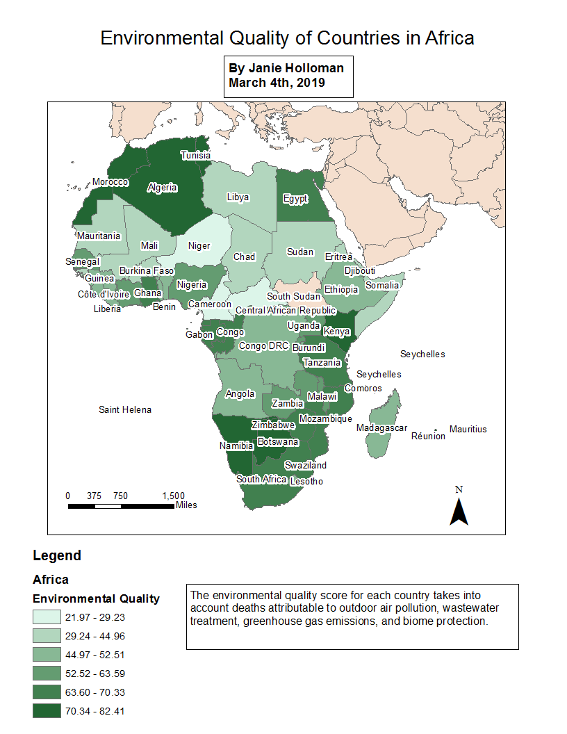
Project | 02 Social Progress Index Map
For this project, the assignment was to create a map showing one of the Social Progress Index categories (via https://www.socialprogressindex.com/) for one region of the world. I chose Africa and the Environmental Quality progress indicator because of my focus on the environment. I included a text box to explain how the score for environmental quality is calculated.
Project | 03
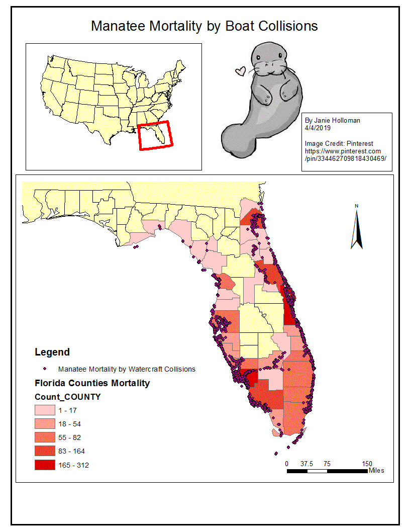
Project | 03 Manatee Mortality
For this project, I mapped manatee deaths specifically by boat collision by county in Florida. I used a graduated red color scale and a really cute manatee to pull on the heartstrings of my audience and communicate how terrible it is that this many majestic creatures die due to boat activities. The dots along with the color scale emphasize the frequency and gravity of the situation.
To see more or discuss possible work let's talk >>
Project | 04
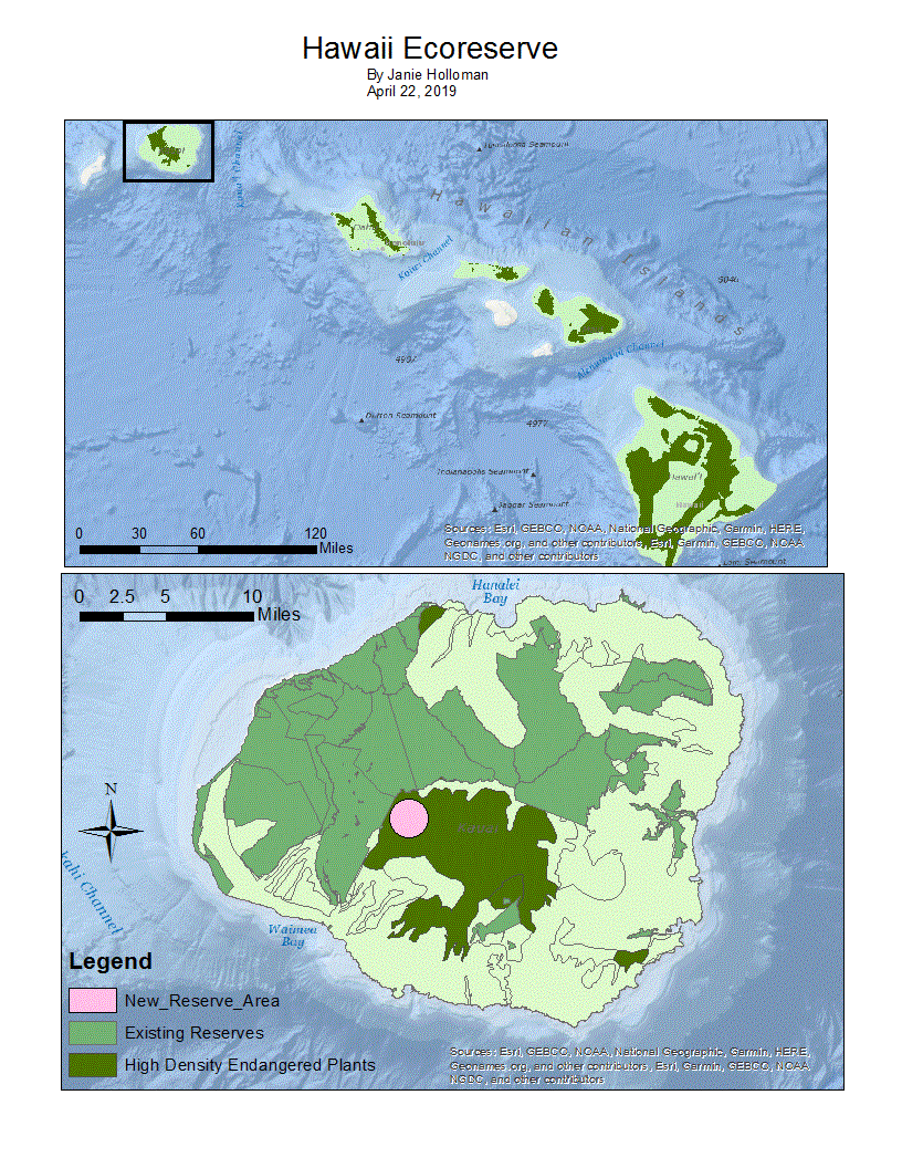
Project | 04 New Ecoreserve for Hawaii
The goal of this project was to design a new area for an ecoreserve on one of the Hawaiian islands. I took data about the endangered plant density of all the islands and chose a very dense area that was not already an existing reserve. Then, I created the circular shape of land to the appropriate size outlined by the assignment and created the pink portion for a new reserve area.
Project | 05
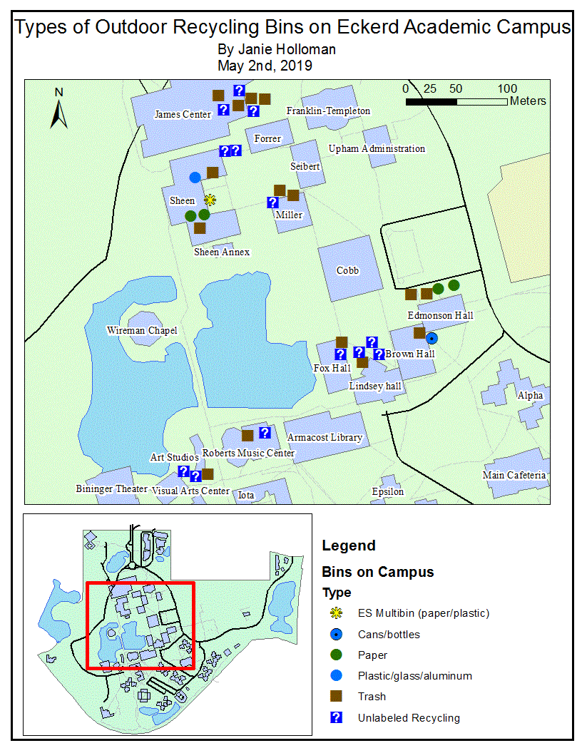
Project | 05 Recycling at Eckerd
The fifth and final project I created was a map of Eckerd College's outdoor recycling and trash bins on the academic side of campus. For five days over the course of the semester, I went out with a group and recorded the location of any outside recycling bins with a GPS unit and aspects relating to use of the bin, such as how full it was, what type of bin it was, whether it contained the right items or not, and whether or not there were animals scavenging in it. Using this data, I created this map individually to show the distribution of types of bins throughout the campus. As you can see, many of the recycling bins were blue but unlabeled, which is one of the problems with the recycling program at Eckerd. These bins are often incorrectly used because they do not specify what should go in them. This project could be used to help improve the Eckerd recycling program.